


Tower Wreck
Tower Wreck
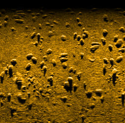
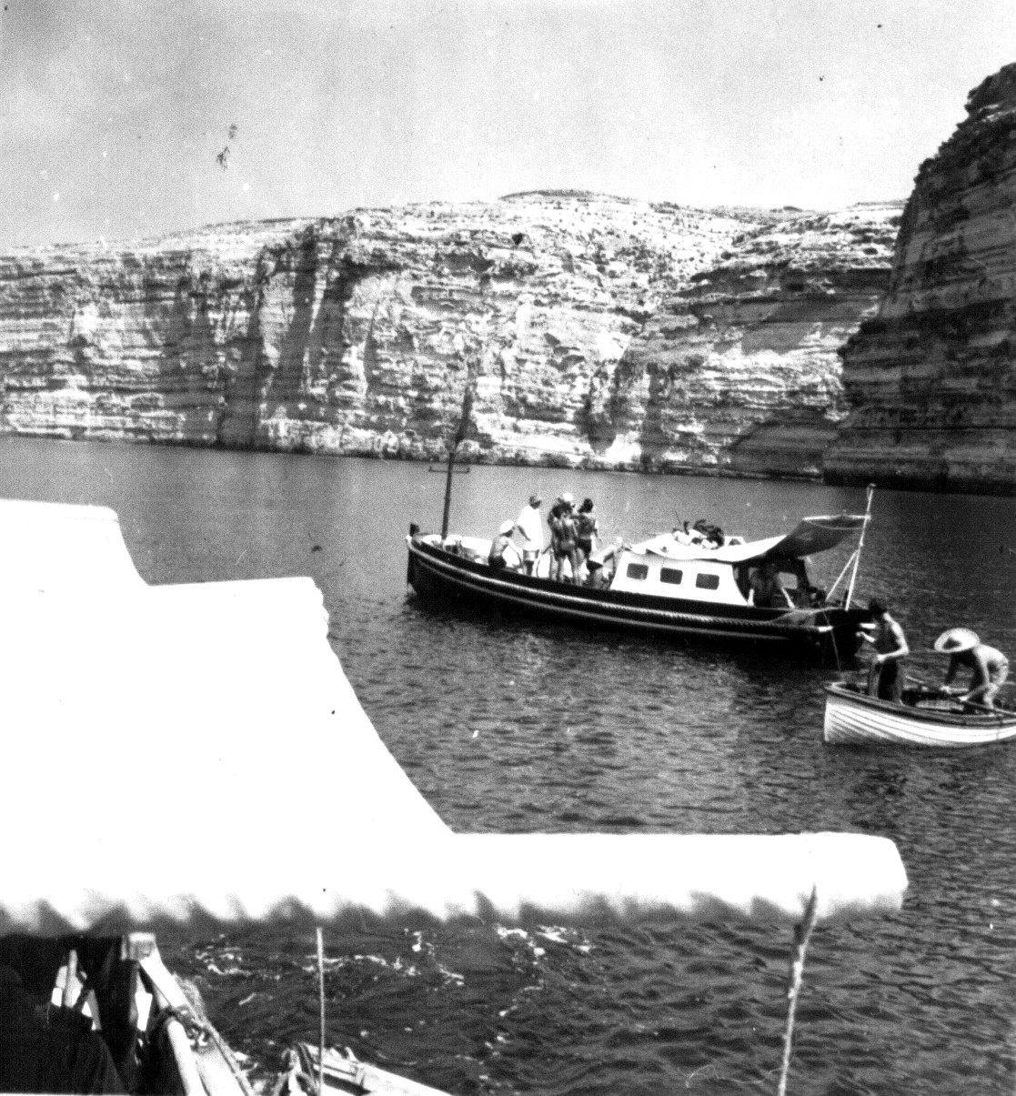
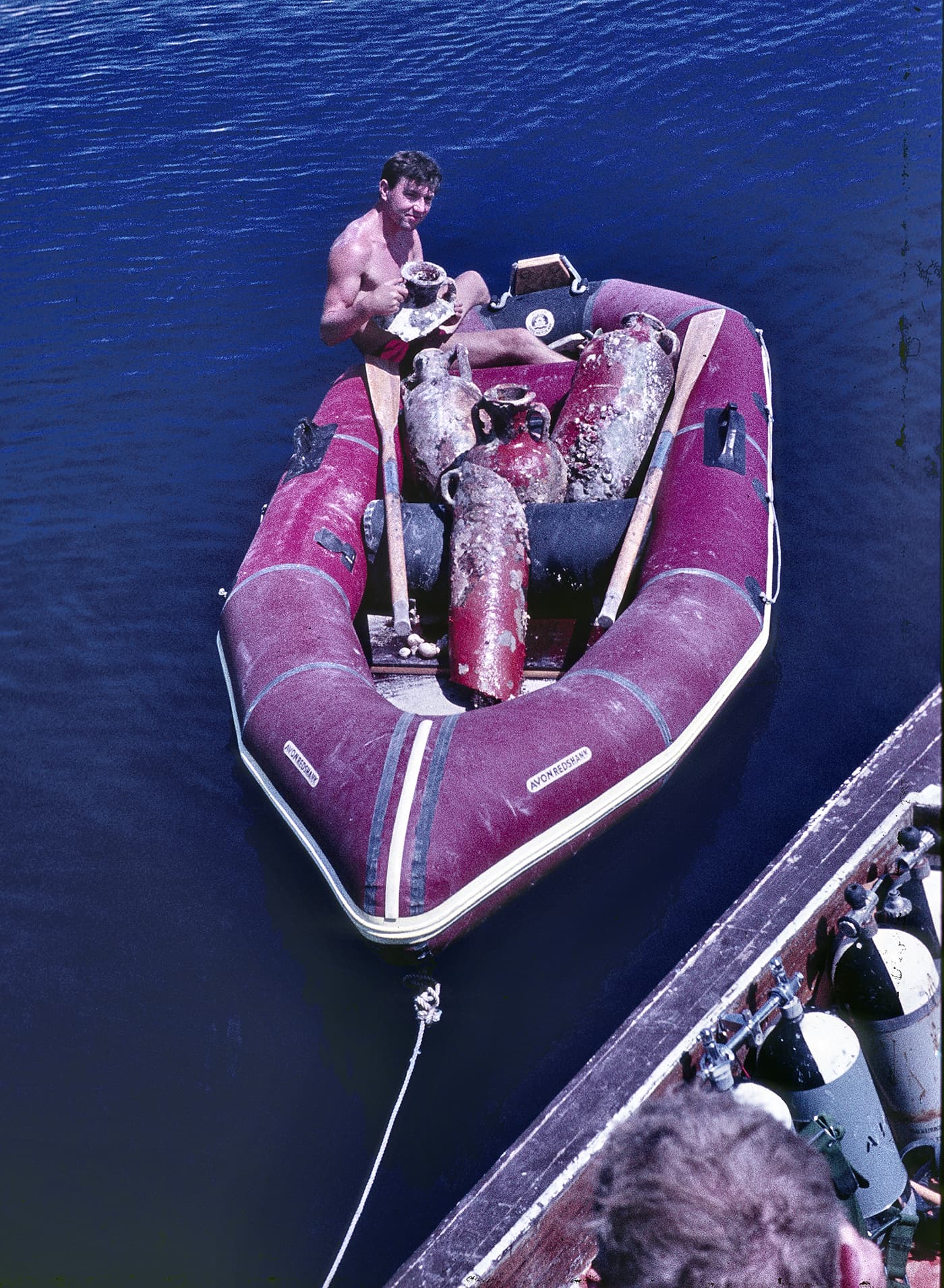
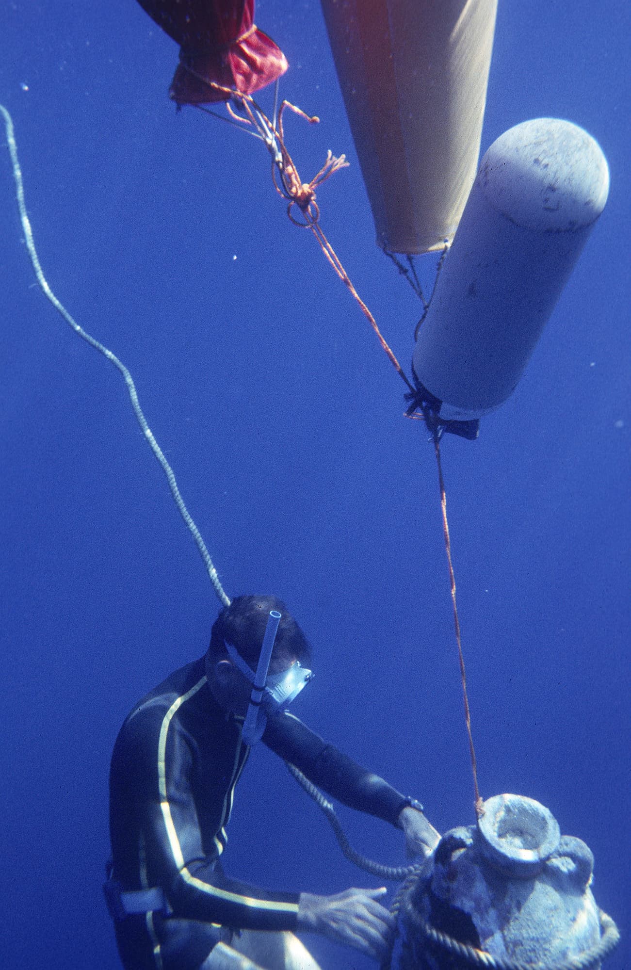
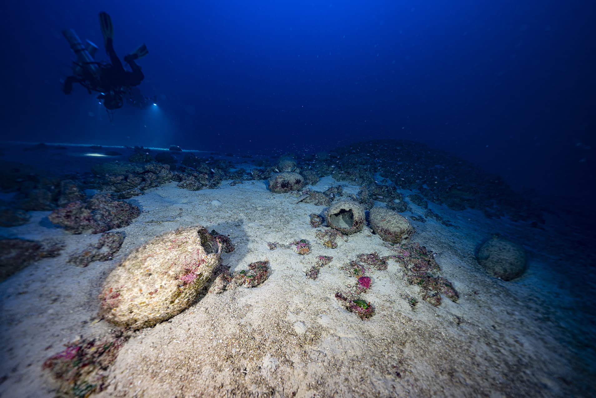
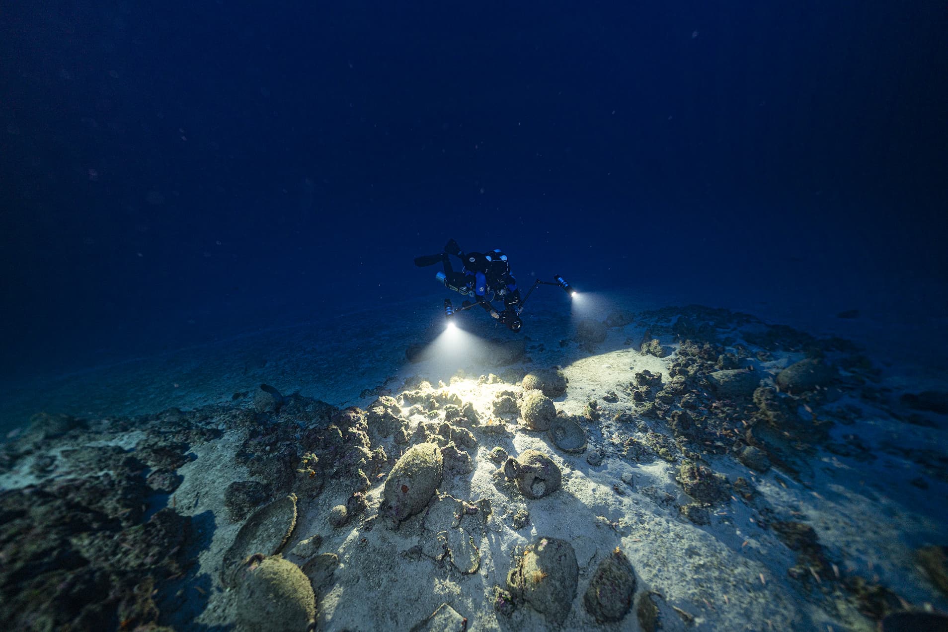
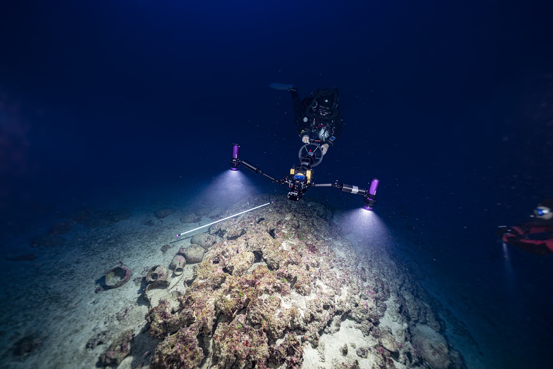
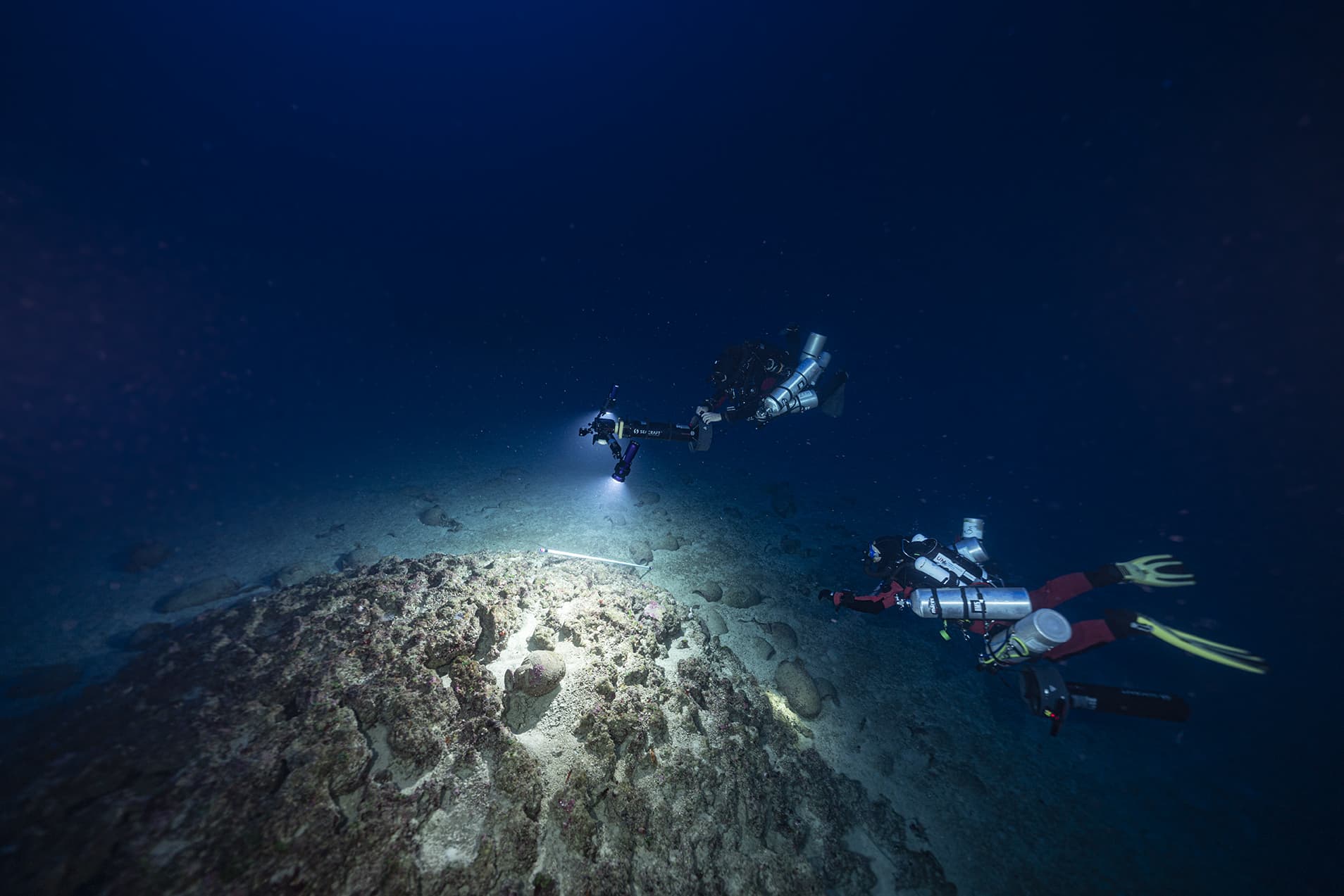
Xlendi bay, a small fishing harbour on the south-western coast of Gozo, has been a hotspot for underwater archaeological discoveries since the late 1950s. Various underwater projects in the 1960s and 1970s focused on the recovery of archaeological objects from the seabed. Recovered objects include amphorae and lead anchor stocks from depths up to 60 m. In 1993, a deep-water submarine survey outside Xlendi bay detected a dense scatter of amphorae at a depth of 105 m. Due to its proximity to the 17th century Xlendi coastal watch tower, this deep-water site is now known as the Tower Wreck.
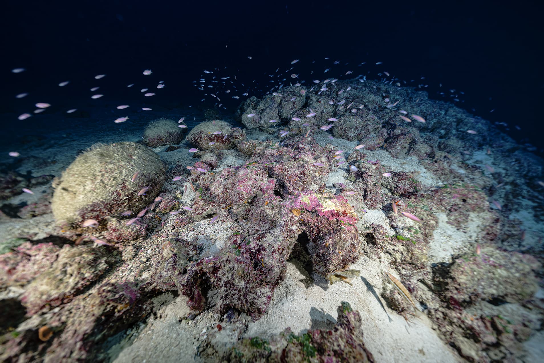
In ancient times the harbour of Xlendi bay would have been larger and more protected than the present-day bay and would have been a hub of commercial activity, connecting to various hubs around the central Mediterranean. The archaeological potential of the bay has been known since the 1960s when various foreign-led projects recorded and recovered numerous cultural objects, most of which are now on display at the Gozo Museum of Archaeology. Remote sensing surveys carried out between 2006 and 2008 sought to, firstly, relocate the deep-water site discovered in 1993 and, secondly, to gain a deeper understanding of the archaeological potential of the area. The extent of the site was recorded and was found to consist of a dense scatter of objects over an area measuring approximately 67,000 m². The depth ranges between 105 and 115 metres, and the seabed consists of a fine silt/sand punctuated by a series of rocky outcrops that measure approximately 1 metre in height and between 3 m to 20m in length. It is around these rocky outcrops that the dense concentrations of archaeological material can be noted. It is also highly likely that archaeological remains are buried in the sediment, based on the continuous deposition of sediment from Xlendi valley and the presence of partially buried objects. Preliminary investigations date the objects to Malta’s Punic period – the 3rd century BC. Whether the site is comprised of one shipwreck or several, or even none, is currently being investigated by Heritage Malta, which launched an ambitious multi-year project to document the Tower Wreck site in 2021. The site is being documented using a process known as photogrammetry, where photos and videos are used to create a virtual 3D record with millimetric accuracy. The site is also being preserved in situ, meaning that excavation is not intended, and in 2023 sections of the site will be made accessible to technical divers. Those members of the public that do not dive are able to virtually explore this unique site here on the virtual museum. All this forms part of the ultimate objective, the transformation of the Tower Wreck site into the world’s first deep-water archaeological park – the Xlendi Underwater Archaeological Park, and is sponsored by the Malta Airport Foundation.
 Protected Marine Life
  Sponsored by the Malta Airport Foundation.
 The Wreck.
The Park consists of a mixed cargo datable to the 3rd century BC and is located at a depth of 105m close to the tower built to guard the entrance to Xlendi bay. The seabed is composed of a fine sandy and silty seabed interspersed with rocky outcrops and dense scatters of archaeological material. Although the deposit consists mainly of amphorae, there are also bowls, urns, and jugs. The rocky outcrops are extinct coral reefs, and the densest concentrations of archaeological material can be found around these reefs. This combination of natural and cultural heritage is an integral part of why the park has been set up. The precise reason for such a dense concentration of material is not yet known, however an ongoing Heritage Malta project aims to answer this fundamental question.


